
 Standing behind Canmore like a sentinel, Ha Ling has become a classic Canmore Hike/Scramble. On the scrambling scale, Ha Ling barely registers, on the hiking scale it ranks in as a difficult. From the front the foreboading cliff of Ha Ling seems inpeneterable, but what reveals itself on the backside is a somewhat moderate slope. It is this slope that attracts the people from Calgary and Canmore to Ha Ling.
 In late June, I decided that I would, along with some friends, hike up Ha Ling. It would be my first hike/scramble since Prairie Mountain on March 5 (almost 4 months ago). None of the group members besides myself had done this trip previously and I thought it would be a great way to get my mountain legs back. So on July 2nd we decided we would have an outing and call it Scotch On The Rocks, named for the drink we would have while sitting on the summit. The hike began modestly as it always does, climbing through trees along switchbacks on a well defined trail. Stepping over some roots and around trees adds a bit of excitement to the otherwise monotonous forest hike. After about half an hour, the trail will begin to provide the first glimpses of the Goat Range and Mt. Rundle before finally breaking the treeline in about an hour and a half. Take time to have a breather at the viewpoints in the forest if you like (we did) but don't dwell too long, the views only get better - and Ha Ling is pretty much all about the views.
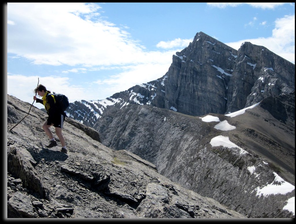
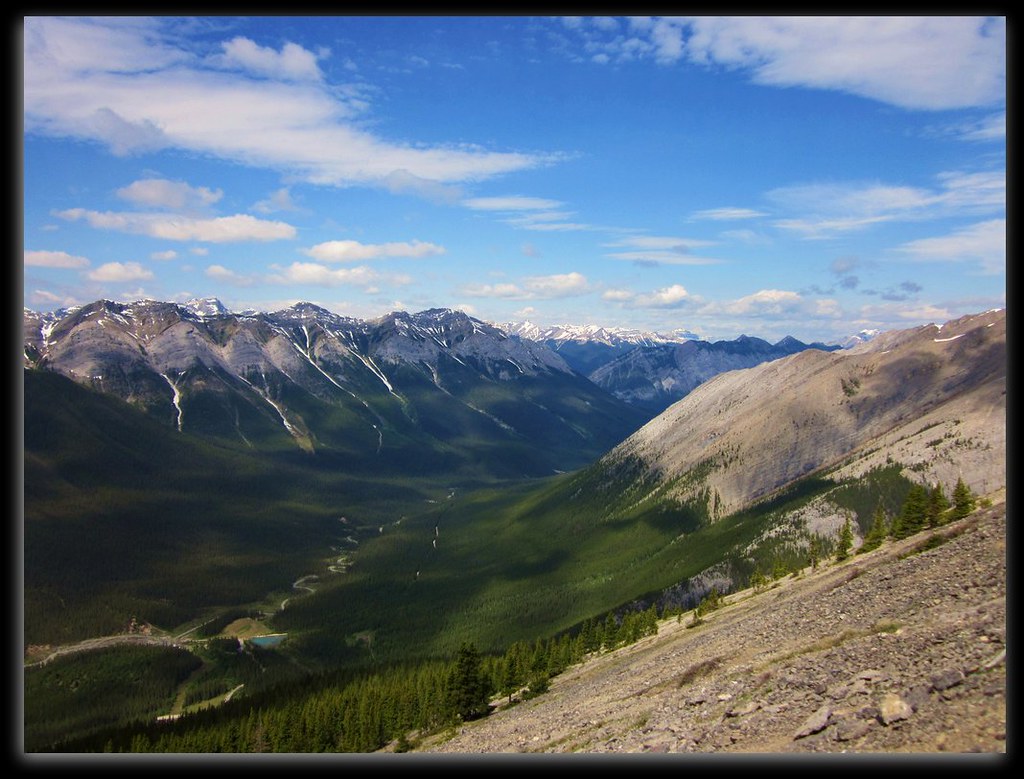 From just above the treeline the path splits into several, all leading to the summit on multiple angles. You have the choice to beeline it stright tot he summit on some loose scree, or you can continue to use the well grooved switchbacks. Once the summit is in view, the mountain holds no tricks, its just a matter of hiking the way up to the summit along one of several scree trails. The col provides a good teaser to what the summit will provide. We met a group there and I urged them to continue, suffice it to say, they were greatful that they took the advice and continued the extra 10-15 minutes to the true summit.
Our group decided to leave early to try and avoid the crowds for which Ha Ling is famously known for. On the way up to the summit we shared the trail with about 3 other groups and found ourselves virtually alone on the summit while we rested and took in the awesome scenery of the Bow Valley. On the descent however, the masses were marching up relentlessly one after the other. Without exaggerating, I would not be surprised if we passed close to 100 hikers on our way down and close to a dozen dogs. Children as young as 5 were making this hike - which goes to show the difficulty of it.
 Unfortunately I do not have a great photo journal of this hike (there isn't exactly a lot to see until the summit) but don't be fooled, on a clear sunny and partially warm day, the summit offers some majestic vistas for the amount of effort put forth. Our summit day provided us with partly cloudy skies and some decent winds blowing off the snowed-in mountains to the west. This wind cause us to opt for a few heavier layers as we sat having lunch on the summit.
The total distance is about 6.5km and the total elevation gained is 729m and from car to car took us about 4.5 hours with a decent summit stop.
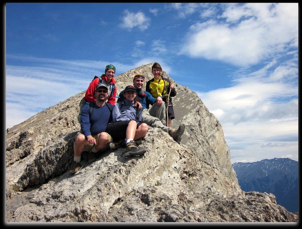 |
| Group Picture From Col |
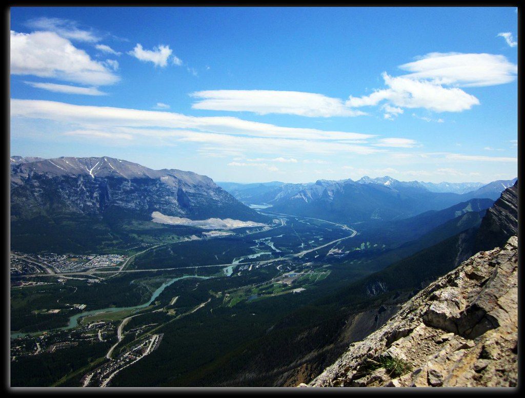 |
| View From Summit Towards Calgary |


